
Water Conservation and Management Systems in Uttarakhand
The first human civilizations were established along the rivers. Over time, various cultures have established an intimate connection with water for survival and religious, spiritual, cultural, and aesthetic purposes. For example, Vedic texts consider water to be purifying in the spiritual context. Rivers as also considered as deities. Since then, man's fascination with water has been the most primitive of all. A biological necessity, water is the basis of every life form.
The inherent value of water and forests are embedded deeply in the beliefs, cultural norms, and socio-cultural traditions of communities in Uttarakhand. They learned to collect rainwater, store it and use it for different purposes throughout the year, which allowed the community to grow as a unique water harvesting civilization. Before the British Raj, the state was not responsible for providing water to its citizens, but it also did not intervene in its people's use of water. The community managed water for irrigation and drinking as per their need. People developed their rules and technologies to accommodate ecological conditions and socio-cultural contexts and created their own systems for traditional water management.. The communities had ownership over local natural resources, and the state recognized this right. Thus, Uttarakhand has an array of traditional strategies for harvesting water evolved, reflecting the various characteristics of each micro-region.
Water sources in Uttarakhand were always regarded as sacred sites; generally, an idol of Lord Vishnu was placed at all natural water sources. Hence the water bodies were well maintained. Most of these sources are in use today and serve a significant proportion of the people's water requirements. This indigenous knowledge system of water conservation included:
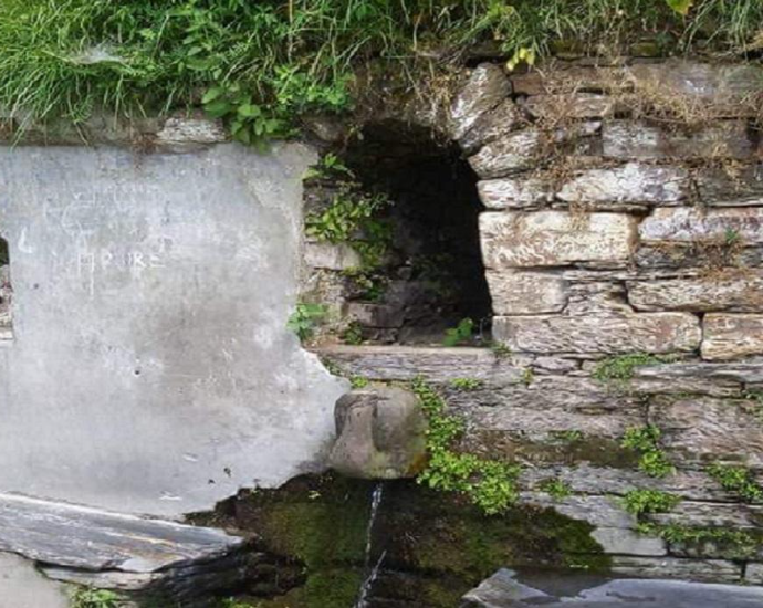
Naula
A Naula is a water temple that houses an aquifer. The structure has a roof sloping on all four sides like a temple, unlike the houses with two sides. Since these structures were considered sacred, a round stone was placed attributing Lord Vishnu. Naulasare found in lower Kumaon, and exhibit marvelous architectural character. These consist of covered tanks open on three sides. The fourth side remains open and has steps leading down to the aquifer.

Figure 1 Ek Hathiya ka Naula. Source: www,euttaranchal.com
The entrance to the Naula is small to discourage animals from entering, and which promotes hygiene and sanitation. At times, these were massive structures with plinths for bathing and washing. The Naulas went down in layers of steps to deepen and narrow the tank, minimising the evaporation of water. The number of steps constructed was always an odd number; the reason for this is not known.
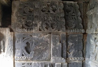
Figure 2 Architectural carvings. Source: www.euttaranchal.com
These springs are susceptible to seismic activity and human interference since Naulas are designed to collect water from subterranean springs. In many parts of Uttarakhand, these sources have dried up due to earthquake tremors and urbanization.
Dhara
A Dhara is a freshwater spring that serves as the primary water source for household consumption. It also acts as a leading source of irrigation water in many parts of the region. Dharas occurs where the sloping ground and impermeable strata intersect with the groundwater table. Water is sourced from unconfined aquifers where the water flows under gravity and channels through carved outlets. These outlets are in the shape of a pipe, although animal figurines like tigers and cows were also found at places.

Figure 3 Depleting Dhara in Uttarakhand. Source: https://cdn.downtoearth.org.in/library
Dharas were built in the middle of the village, so that all the villagers could conveniently collect water from them. Planting trees at the source was a practice to symbolise the sanctity of water. Depending on the height and nature of the flow, there are three types of Dhara. If an individual can easily drink water from the Dhara in a standing position, it is called a Sirpatia Dhara; if one has to bend over to drink water, it is called Murpatia Dhara. Both these types are decorated with animal figurines. The third type of the Dhara is not perennial, and during the rainy season, a stream or a spring gets recharged. Due to their temporary nature, these are called Patveedia Dhara (Patveedia means ephemeral).
Gadhera
Gadhera is a small water channel originating from a natural resource, which further forms tributaries (gad). All major rivers are defined mainly through the flow of the many major streams called gadhera in Uttarakhand.

Figure 4A Gadhera. Source: thethirdpole.net
Gul
In Kumaon, cultivation is mainly done on terraced fields, and since ancient times, the irrigation problem was solved by diverting water from nearby streams or rivers through channels called guls. They are an example of water resource management in hills and usually dug out along the slope's contour. Other than irrigation, guls were used for drinking water and running gharats or water mill. One can spot outlets along the length of the gul, which lead to small secondary channels, known as hawarr. A boulder placed on the outlet controls the flow of water. The lower end of the field allows the excess water to flow onto lower terraces from where it ultimately drains back to the stream.
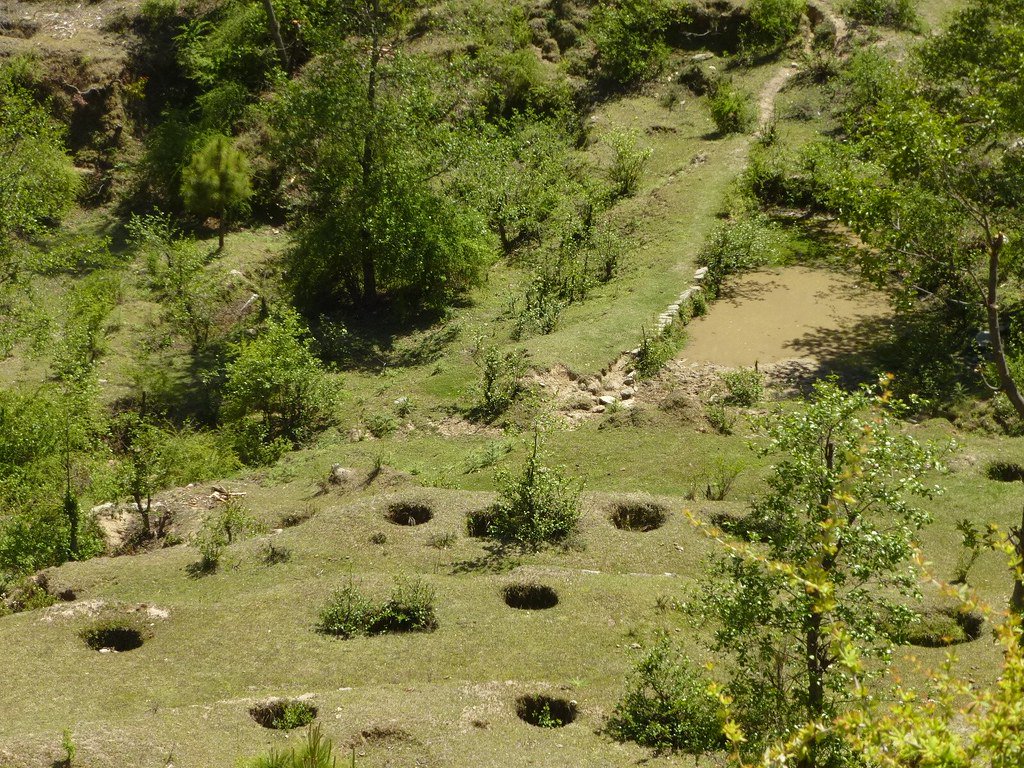
Figure 5 Terrace cultivation and irrigation. Source: https://twitter.com/Anoopnautiyal1/
Khal
Large depressions in mountainous areas used for rainwater harvesting are called khals. Normally these are on the top of ridges in the saddle between two crests. At times small ponds are also dug for collecting rainwater. During dry periods, water accumulated in khal is used for irrigation purposes.

Figure 6A Khal dug out for storing rainwater. Source: cpreecenvis.nic.in
Simars
Simar is a marshy tract of land in an agricultural field that is naturally created by the groundwater. It is aptly suited for paddy cultivation. Cultivation of high-quality crops like basmati rice, medicinal plants and herbs are a common feature in Simar.
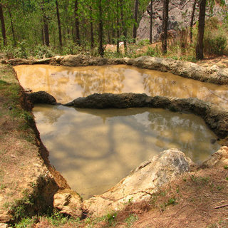
Figure 7Simar. Source: https://www.researchgate.net/
Chuptyaula
These are water holes for animals and are found chiefly in high altitudes for the use of grazers. They are temporary, and water collects in them from springs or points where water oozes out from springs or points where water oozes out from the ground.
The present-day adherence to rituals like Kalash Vivah and Namkaran Sanskar confirms the role of these water structures in evolving the region's cultural and social character. These customs indicate that the ancestors understood the importance of water conservation systems and included them in their rituals as family members. Water conservation requires an integrated practical approach and local communities must be involved in this process. We must utilize our vast traditional knowledge and experience to save this precious resource.
REFERENCES:
https://www.downtoearth.org.in
https://www.indiawaterportal.org/articles/celebrating-uttarakhand
http://nwm.gov.in/sites/default/files/Report_Draft-SSAP_Uttarakhand.pdf